


Have you ever wanted to know how LiDAR helps us uncover hidden cities in dense jungles? In this blog, I want to explain how LIDAR works to reveal lost cities buried beneath the lush canopy of the jungle.
The Challenge of Dense Jungles
Jungles are places of lush vegetation, thick undergrowth, and dense tree canopies. This makes it nearly impossible to see what just beyond the trees in front of you, leaving much of the story of what was once there hidden. Unearthing ancient cities, temples, or ruins in such environments would require superhuman efforts. This is where LIDAR steps in as a superhero of archaeology.
Laser Beams and the Jungle
LIDAR works by sending out laser beams—intense, focused beams of light that are invisible to the naked eye. We mount the spinning sensor on a small plane or drone to get a birds eye view. Many of the laser beams hit the leaves, but a small fraction can penetrate through the jungle canopy, reaching the ground and everything underneath it.
Measuring the Return Trip
Once the laser beams hit the jungle floor or any structures hidden beneath, they bounce back to the LIDAR device. The device calculates the time it takes for the laser beam to travel to the ground and return. This timing allows LIDAR to determine the distance between the device and the object.
Building a Detailed Map
LIDAR doesn’t stop at measuring a single distance; it rapidly measures hundreds of thousands of distances per second. These measurements create a dense 3D point cloud of the entire forest from bottom to top. It’s like LIDAR is taking millions of measurements, stitching them together, and forming an incredibly detailed map of anything the laser touches.
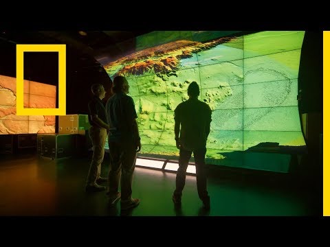
Revealing Hidden Cities
Now, here’s the real magic: once the scan of the jungle is captured, we can flip it over and see the bottom most layer. Even though this is just a tiny fraction of the entire survey, its a map of whats on the jungle floor like it was before everything grew back over it. It can reveal the shapes of ancient buildings, roads, and other structures that are now concealed by the dense vegetation. We simply delete everything above that bottom most layer and we have a map through time.
Benefits of LIDAR in Jungle Archaeology
LIDAR’s ability to see through the jungle canopy has revolutionized the field of archaeology:
- It accelerates the discovery process by quickly mapping vast areas.
- It provides high-resolution 3D data, making it easier to identify archaeological sites and plan excavations and conservation strategies.
- It preserves the environment by minimizing the need for physical excavation, which can damage the delicate existing ecosystem.
In the world of exploration and archaeology, LIDAR serves as an incredible tool, allowing researchers to uncover the secrets hidden beneath dense canopies. By using laser beams to penetrate the jungle and create detailed 3D maps, LIDAR has already unveiled lost cities and brought forgotten civilizations back into the light. As technology advances, we can only imagine the incredible discoveries waiting to be made in the depths of the jungle, thanks to the superpower of LIDAR.
Lost Cities with Albert Lin is powered by the tireless efforts of my technology team and partners at Visual Skies (Link: https://visualskies.com <https://visualskies.com>)
For more info on the science of LiDAR in archaeology check out my friend Tom Garrison’s LLAMA lab (Link: coming)